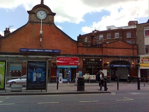
Hammersmith station, Hammersmith & City and Circle lines. The Piccadilly and District lines run from a separate station over the road. This station was built in 1868, four years after the original Hammersmith station was opened. It was located slightly north of the present station.
|
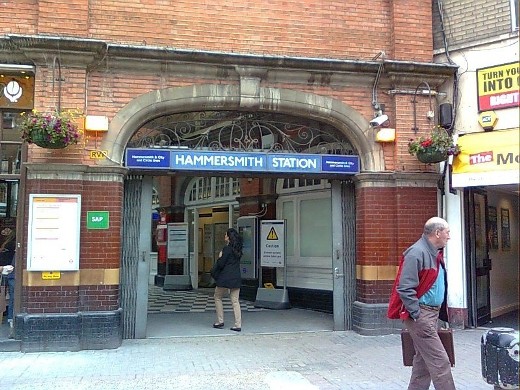
The entance to the station is on the right hand end of the building.
|
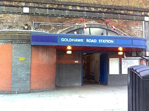
Goldhawk Road station opened in 1914, long after the line itself was in use.
|
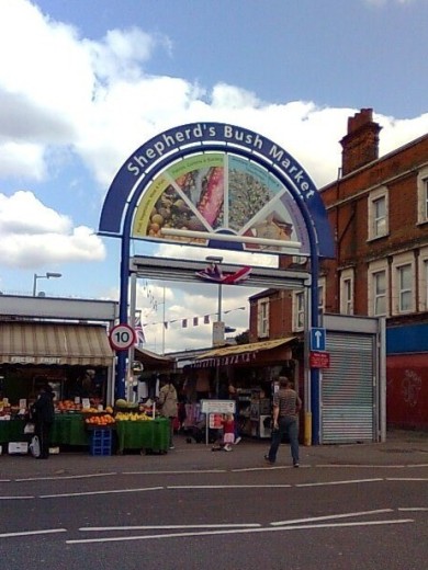
The walk to the next station takes us through Shepherd's Bush Market which runs alongside the tube line and consists of a single line of stalls either side of a central path.
|
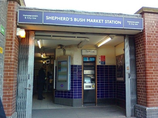
Shepherd's Bush Market station which was called simply Shepherd's Bush until 2008. The renaming of the station ended 108 years of confusion with there being two stations with the same name 500 yards apart.
|
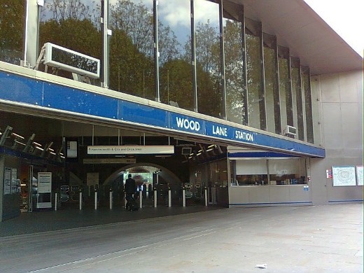
Wood Lane station was opened in 2008 in order to serve the new Westfield shopping centre. The station was given the name of a disused station on the Central line which was situated nearby and closed in 1947.
|
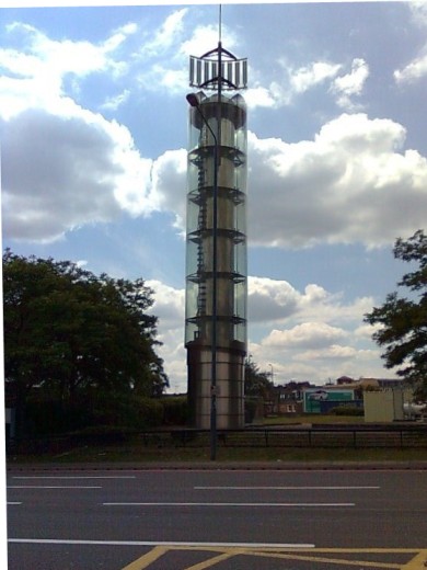
The way to the next station is barred by the West Cross Route which was formerly the M41, so we must walk well away from the Tube track. The nearest place to cross the road is at the Holland Park roundabout upon which stands the Thames Water Tower shown here. It is a large barometer, sadly no longer working but which used to hold blue water which rose as the atmospheric pressure rose so indicating good weather.
|
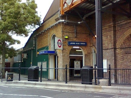
Latimer Road station.
|
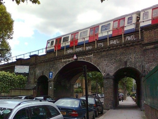
On the way to the next station, a Tube train rumbling above us on the bridge reminds us that the previous four stations along with the next one have platforms at this raised level.
|
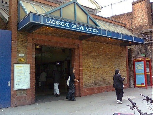
Ladbroke Grove station. The roundels on the platforms include the words 'for Portobello Road' indicating that it's the nearest station to the famous Portobello Market.
|
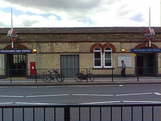
The double entrances of Westbourne Park station.
|
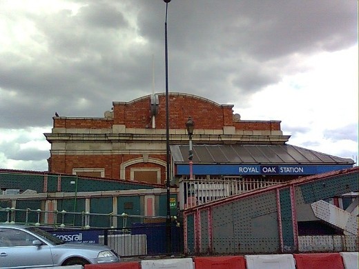
The very sorry looking Royal Oak station with the quaint building sitting on an ugly bridge.
|
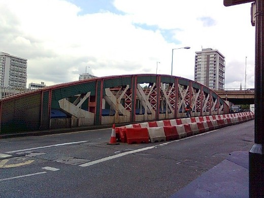
A better view of the bridge showing the metalwork construction.
|
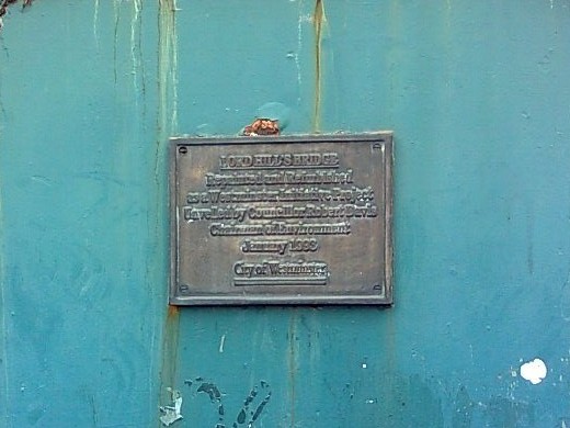
A plaque on the bridge tells us that it is called Lord Hill's Bridge and was refurbished and painted in 1993.
|
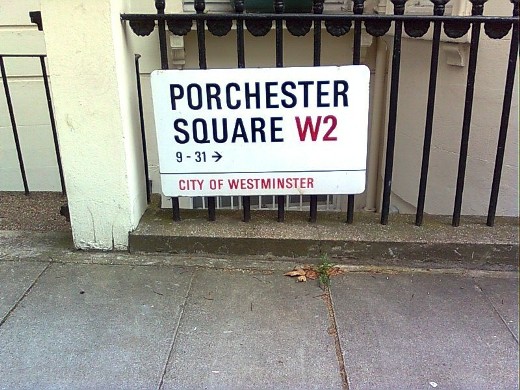
The walk to the next station takes us down a road confusingly named Porchester Square on one side ...
|
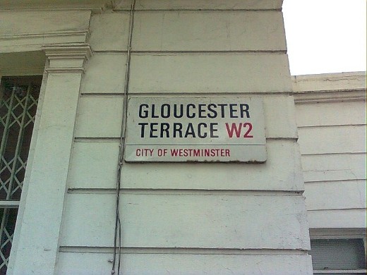
... and Gloucester Terrace on the other side.
|
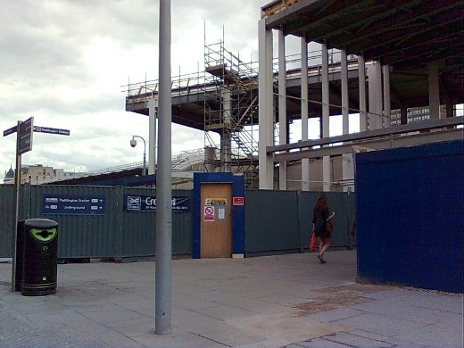
The north entrance to Paddington station with the entrance to the Hammersmith & City and Circle lines just inside, quite separate from the Bakerloo, District and Circle lines station with its entrance in Praed Street.
|
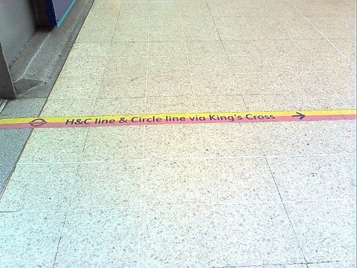
Coloured markings on platform 8 show the way from the main station entrance to platforms 15 and 16 for the Tube.
|
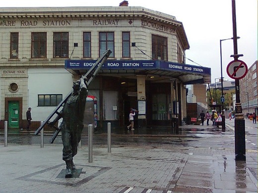
Edgware Road station not to be confused with the station of the same name on the Bakerloo line. The building, with its light coloured stone, is a typical Charles W Clark design. There are several more between Edgware Road and Farringdon. The statue is a work by Allan Sly called the Window Cleaner. He is looking up at the windows in the tall Capital House.
|
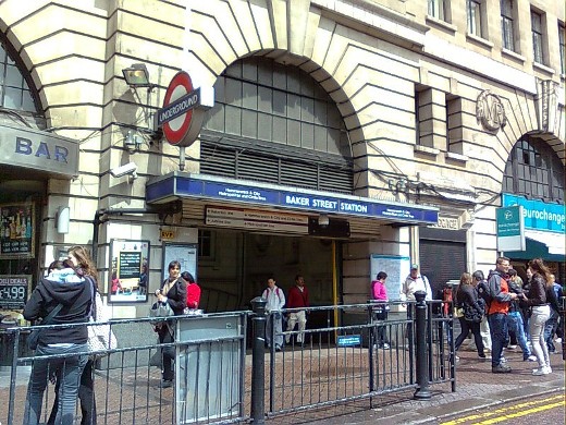
The entrance to Baker Street station in the building that was once the headquarters of the Metropolitan Railway.
|
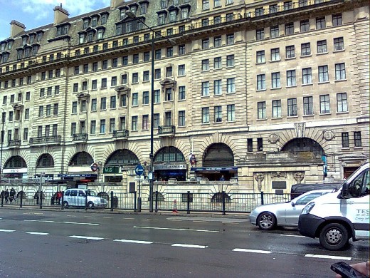
Showing more of Chiltern Court, the old station building. It was the most luxurious apartment block in London when it opened in 1929, with the residents having direct access to the platforms below. They also had access to an exclusive restaurant which is now a Wetherspoons pub, the ceiling of which is very ornate and still decorated with stucco crests of the Metropolitan Railway.
|
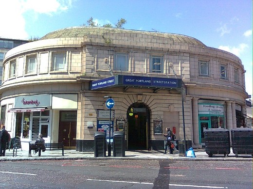
Great Portland Street station was called Portland Road when it opened in 1863 and the name changed in 1917.
|
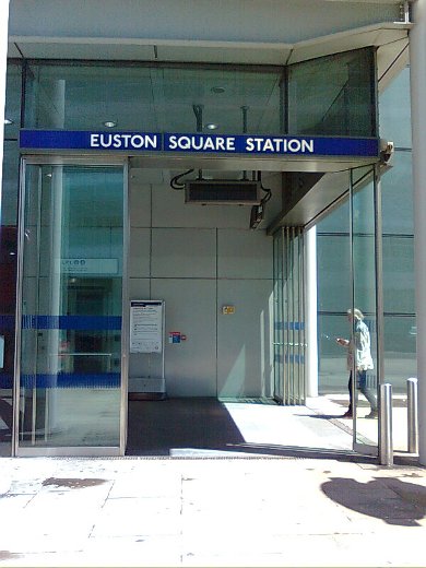
The modern entrance to Euston Square station in the corner of the Wellcome Trust building. Opened in 1863, the station was named Gower Street, changing to its present name in 1909.
|
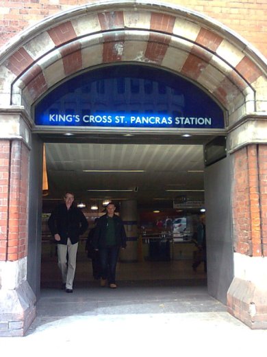
One of the many entrances to King's Cross St Pancras, the biggest interchange station on the London Underground serving six Tube lines as well as two National Rail stations. The first Underground station at King's Cross opened in 1863 and has been rearranged several times since. The most recent upgrade to the Tube station was completed in 2010 with new ticket halls and 300 metres of new passageways being constructed.
|
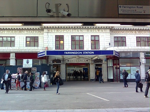
The beautiful Farringdon station building. In 1863, Farringdon Street station was opened a short distance away as the terminus of the original Metropolitan Railway and was relocated to its present position in 1865. It was renamed Farringdon & High Holborn in 1922, the name can still be seen on the facade today. The name was changed to Farringdon in 1936.
|
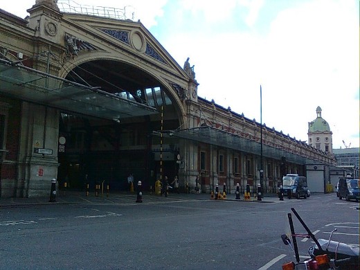
Just beyond Farringdon station stands Smithfield Market properly named London Central Markets, the largest wholesale meat market in the country open since 1868. The picture shows the central arcade Grand Avenue on the left with market space on the right.
|
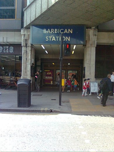
Barbican station was originally called Aldersgate Street, changed to Aldersgate, then Aldersgate and Barbican, and finally to its present name in 1968. The entrance is through a modern building to an older footbridge leading to the eastern end of the platforms. From the other end of the platforms, the western side, can be seen the beginning of the tunnels going under Smithfield Market where at one time livestock were unloaded from trains.
|
One of the entrances to Moorgate station, formerly Moorgate Street station. Below, hidden away, amongst a number of disused tunnels and subways, is a Greathead shield still embedded in the walls of a tunnel it was carving out when the building of an extension to Lothbury was abandoned in 1903.
|
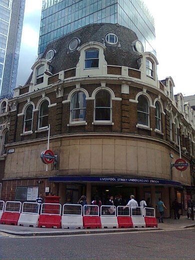
Liverpool Street station, separate from the mainline station over the road, although the Tube can also be accessed from the mainline station concourse.
|
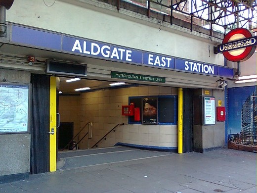
Aldgate East station opened in 1884 as part of the eastern extension. It was sited some 500 feet to the west of the current station. In 1935 work started to enlarge the triangular junction at Aldgate to allow for a more gentle curve from Liverpool Street to Aldgate East. The new station opened in 1938. When Aldgate East station was resited, the next station, St Mary's, was closed. No obvious evidence of the station remains overground.
|
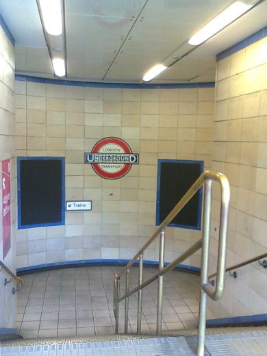
Just inside the station entrance showing the 1930s style roundel on the wall.
|
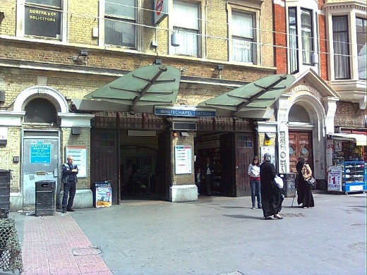
Whitechapel station with the odd arrangement whereby the Underground line platforms are sited at surface level, albeit in a cutting, with platforms for the Overground trains below.
|
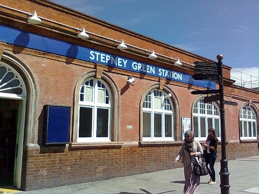
Stepney Green, a subsurface station, was opened in 1902.
|
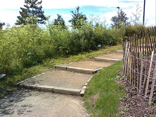
Just before the next station, steps lead up to Mile End Park, a two and half mile strip of countryside which bridges the road at this point.
|
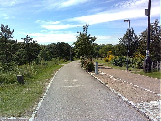
The park is a wonderful, peaceful oasis away from traffic noise in a busy part of London, although the picture doesn't really do it justice.
|
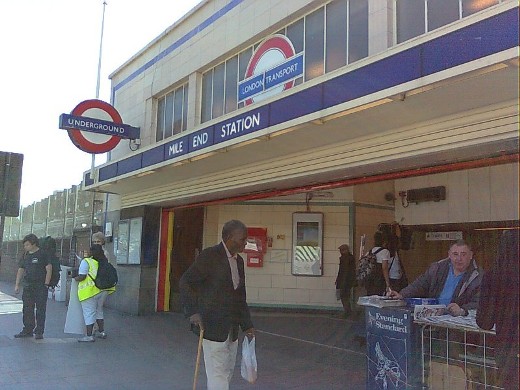
Mile End, the only subterranean station on the network with cross platform interchange between subsurface and deep level Tube lines.
|
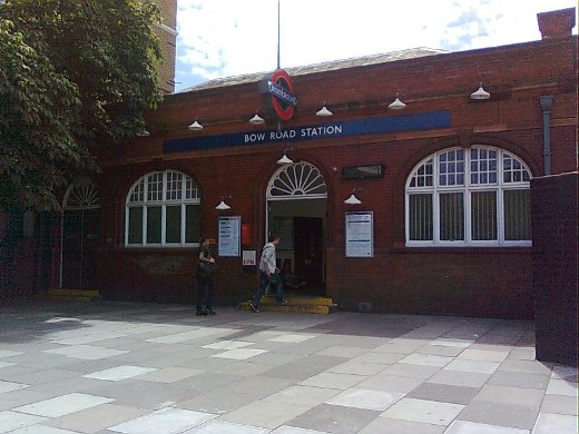
Bow Road station, a Grade II listed building. Platforms here and beyond are at surface level, the line having climbed out of a tunnel on the steepest tunnel exit on the Tube network.
|
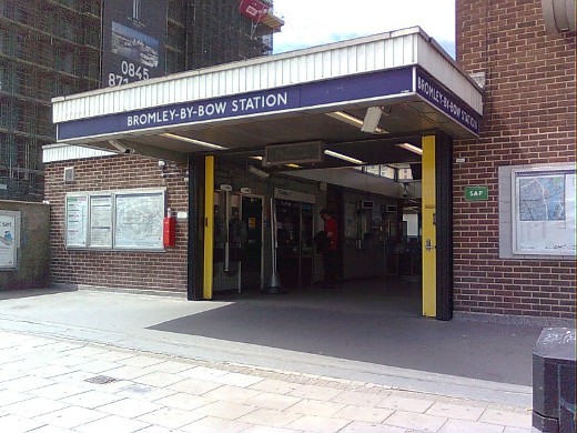
Bromley-by-Bow originally called Bromley and renamed in 1967. In the television programme Eastenders, this is the station replaced on the map by Walford East.
|
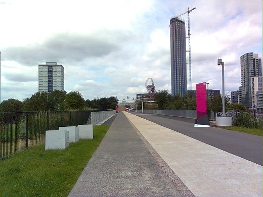
The walk to the next station takes us along a wide pathway called Greenway, and looking back, the Olympic Stadium can be seen at the end of the path with the Orbit Tower alongside.
|
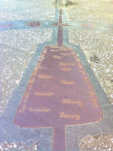
Further along Greenway an analemmatic sundial set in the path needs a person to act as the gnomon. The meridian line is also marked.
|
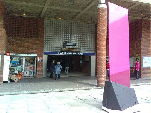
West Ham station is served by the Hammersmith & City, District and Jubilee lines along with the Docklands Light Railway and National Rail. It has eight platforms, the northern upper pair, platforms 1 and 2 are used by the Hammersmith & City and District line trains.
|
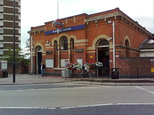
Plaistow station was opened in 1858 by the London, Tilbury and Southend Railway. Apparently the LTSR motif can still be seen in the architecture although I failed to identify it.
|
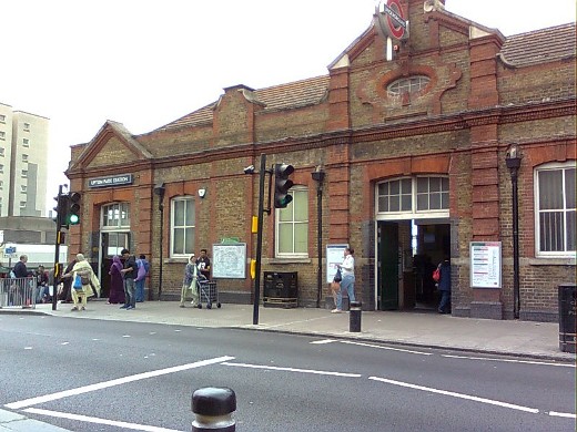
Upton Park station, like several other stations on the line, was opened by the London, Tilbury and Southend Railway. The original station building was demolished in 1903 and the present building built on the same site.
|
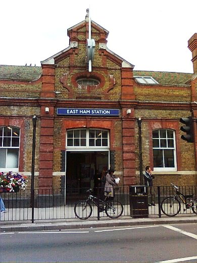
East Ham station building identical in style to the previous station, Upton Park.
|
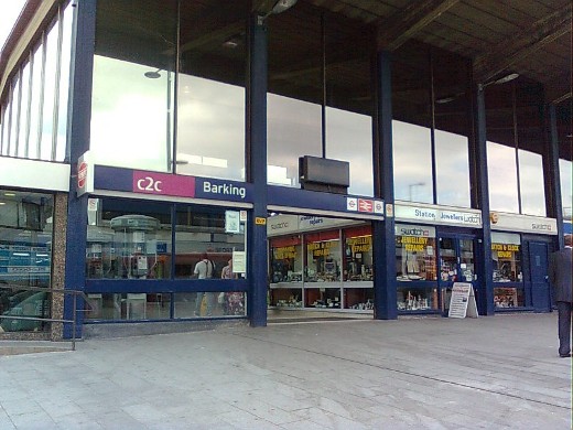
Barking station, the eastern terminus of the Hammersmith & City line.
|
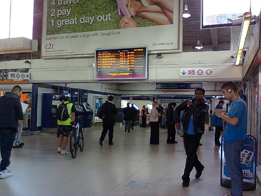
Inside the building, the entrance to the platforms. Hammersmith & City line trains run from platform 3 which is set beyond the other platforms and accessed through a gate at the far end of platform 2.
|